
This map shows the 7 continents, the 5 major oceans, and the imaginary grid of latitude and longitude lines. Notice it also includes a map scale.

The world map above shows all the countries of the world. Although, you might not be able to make out all the names, you can clearly see the political boundaries and see the different nationalities of the world. Each of these countries have their own government system, their own laws, many have their own form of currency (money), and their own individual culture.

On the map above you can see the major mountain ranges of the world highlighted in purple.

The above map shows the major deserts of the world.

This is a world population density map. More orange dots means the area is more populated.

This pie chart shows how the continents stack up to each other with regards to population. Notice that Asia has over half of the world's population.
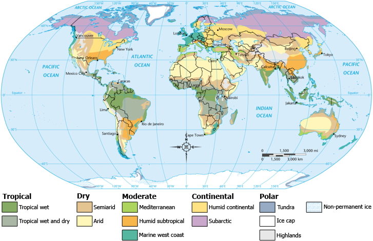
The map above is showing the different climate zones throughout the world. Climate refers to long-term weather patterns.
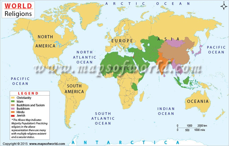
The map above is showing the major religions of the world and in what areas that they are the dominant religion.
The following website is a great site that has tons of different types of world maps (religions, climates, population, countries, government systems, world money, etc.)
http://www.mapsofworld.com/
"Big Picture" questions to think about and comment on:
1) How are countries and continents different?
2) Where are the continents and oceans located on the world map?
3) Where is the Amazon Rainforest, the Sahara Desert, the major mountain ranges of the world, biggest cities of the world, major countries, etc. located on a world map?
4) What is the significance of the equator? What about the Prime Meridian?
5) How do the Equator and Prime Meridian create the 4 hemispheres? What hemisphere do we live in?
6) Define geography.
7) Define culture.
8) How does physical geography affect population?
9) How does climate affect population?
10) How does physical geography affect culture?
1.) Countries and continents are different because a continent is a large continuous landmass and a country is geographical territory.
ReplyDelete3.) The Amazon Rainforest is located in the northern part of South America and the Sahara desert is located in Africa..
5.) we live in the Northwestern hemisphere.
6.)Geography is the stud of the earth.
-Amy Long
ReplyDeleteGood answers Amy!! I'm glad that you're using the blog.
ReplyDelete